NOAA has awarded Black Swift Technologies (BST) a contract to develop GPS-denied navigation, enabling Beyond Visual Line of Sight (BVLOS) operations for drones in GNSS-denied environments. NOAA has almost 95,000 miles of domestic coastline to survey – and while drones are by far the best way to complete the mission, flying …
Read More »NOAA Launches Autonomous Drones to Study the Bering Sea
Source: NOAA It’s not an Ark, but NOAA is charting a new course for aquatic research using autonomous drones. The federal agency recently launched a sea-going sortie of three aquatic drones bound for the Bering Sea. The drone fleet will survey the nation’s largest fish stock and monitor changing weather …
Read More »NOAA Launches Expanded Drone Program
Source: NOAA NOAA is predicting clear skies for a new drone program the agency rolls out this week. In a media statement, the agency announced the launch of the Unmanned Systems Operations Program. “The new program will promote the safe, efficient and economical operation of unmanned systems NOAA uses to …
Read More »NOAA Research: Drones Improve Hurricane Forecasting
Courtesy: NOAA Drones may someday become the first line of defense in hurricane forecasting. A NOAA research paper in Bulletin of the American Meteorological Society reveals that disposable UAS could be used to gather data from a hurricane’s lower eyewall – the most dangerous part. “It’s where the storm draws …
Read More »Drones Continue to Make an Impact in Marine Conservation
We’ve written on a number of events about how drone expertise is getting used for marine analysis and conservation, significantly with efforts involving our oceans’ largest inhabitants: whales. You can examine Ocean Alliance’s work to seize whale information utilizing SnotBot, right here. You can examine Intel and Ocean Alliance utilizing …
Read More »Drones are Helping Scientists Weigh Seals in Antarctica
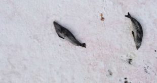
It’s at all times good to see a optimistic drone story. Today we’ve heard a couple of new approach in which drones are serving to with conservation efforts. A mission in some of the distant components of the world, Antarctica, has proven that aerial images can be utilized to successfully …
Read More »NOAA Partners with Drone Firm To Forecast Wildfires
The National Oceanic and Atmospheric Administration is taking swift steps to foretell wildfires by partnering with a drone agency. Colorado-based Black Swift Technologies lately introduced the drone deal – the deployment of “a tightly integrated system consisting of an airframe, avionics, and multiple sensors capable of research-quality measurements of CO2, …
Read More »Floating Drones: Saildrone Gets $14 million in Funding
While most people think of drones in the air, CA-based Saildrone Inc., is using drone technology on the ocean. Saildrone doesn’t call themselves a drone company, but rather “a provider of ocean data collected by a fleet of unmanned, autonomous sailing drones.” Used by NOAA as part of their drone exploration program, …
Read More » Unmanned Aerial Vehicle The latest drone news
